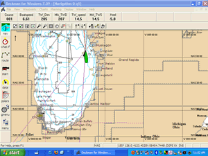
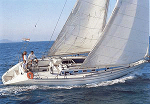
|
The world's most
advanced race navigation software - used on winning yachts from
local regattas to ocean races and the America's Cup.
Deckman has numerous functions
to assist the racing navigator and improve performance:
-
Simple waypoint and course
management
-
Quick and easy zoom and pan
controls
-
Complete predictions for future
legs
-
Dedicated start display
-
Flexible data logging and
plotting
-
Control of instrument system
-
Wind calibration facilities
-
Easy control of polar tables
-
Calculation of laylines
-
Tracking competitors and
time-on-time handicap calculations
-
Route optimization
-
Display of wind and current data
-
Compatibility with most major
chart systems
Charts
-
C-Map version supports: C-MAP,
BSB, Maptech, PCX and REML charts
-
Euronav version supports: ARCS,
Livechart, BSB, Maptech, PCX and REML charts
-
Alternatively use any image file
as a chart for a powerful planning or analysis tool (e.g.
satellite photo, aerial photograph or ocean current chart)
Optimum routing
-
Deckman will calculate the
optimum route between two points or for a whole route:
-
Graphical or tabular presentation
of optimum route
-
Tidal database for popular areas
-
Optimum routes taking into
account land masses around land
-
Supports standard GRIB* weather
files (with GRIB Weather module)
-
or create your own for wind and
current
-
In-built tools for OCENS
WeatherNet and Saildocs downloads
-
Compatible with SHOM tidal data
(Channel and Biscay) and Local Knowledge Current models
-
Unique reverse routing
algorithm to analyse competitor positions and effect of leaving
optimum route
-
GRIB is the standard
meteorological digital file format which includes wind, pressure
and sea state information which can be viewed in Deckman for
Optimum routing.
Wind calibration
Start display
-
Special display giving you all
the information you need for the start:
-
Line bias
-
Time and distance to each end and
nearest point on the line
-
“Time to burn” option - shows
positive when early or negative when late
-
Set ends of line by “pinging”,
range/bearing, latitude/longitude and then adjust with simple
nudging
-
Flexible countdown timer
including synchronize function
Marks and courses
Positioning of waypoints by a choice of methods:
Data
Flexible data facilities:
-
Vertical wind plot of TWS and TWD
-
Time series plots of any data
-
Next and leg information
-
Output any data directly to
displays and toggle data shown
-
Continuous logging of all data
for later analysis
-
Customizable logging for specific
analysis
-
Record set-up using custom boat
parameters (e.g. Sails, helmsman)
-
Speed test comparison tools
including 3-D graphs
-
Track positions of competitors in
longer races, either by manual input or from files from race
organizers
Polars
-
Flexible input of polars
information including VPP targets which is also easy to adjust
on the water while sailing.
-
Separate polars for navigation
calculations, performance targets and start routines.
-
Advanced polar curve algorithm
for more accurate VMG target tracking
-
Upload polar information from
your compatible instruments and send back the altered values.
-
Supports input of speeds in
"seconds per mile”
Advanced features
-
Advanced user calibration of data
variables
-
Time to turn and accelerate in
start display
-
Laser range finder interface to
set positions of marks or track other
-
competitors
-
Support for Microsoft .NET
framework allows users to develop their own bespoke add-ins
-
Networking of multiple PCs using
Deckman connected to one instrument system
|
 |
